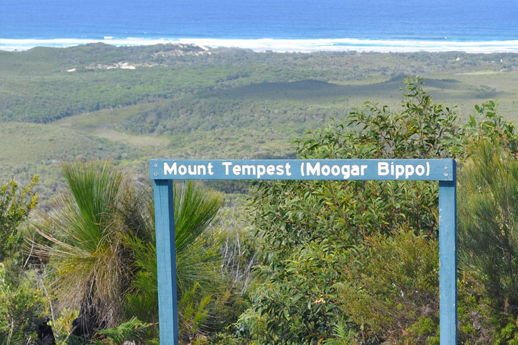
Adventure seekers and fitness enthusiasts who’re looking for amazing and healthy ways to explore Moreton Island have probably heard of Mount Tempest. It’s the official highest sand dune in the world with a height of 290 meters above sea level.
Reaching a top of Mount Tempest requires a hike that lasts about 3 hours, but the good news is that almost anyone can complete the hike and enjoy the 360-degree view from the top.
How to reach the top of an iconic Mount Tempest and get to the hiking trail? Keep reading as we’re going to provide you with details!
The Trek
Mount Tempest is located literally in the middle of Moreton island, deep in the forests of national park.
There are few ways to reach the beginning of a hiking trail from the north and the south of the island.
If you’re staying in Bulwer, then take and follow the road called Bulwer Blue Lagoon until the crossroad with Telegraph Track that will lead you all the way to Mount Tempest Track.
For people staying in the middle of the island, Cowan Cowan or Tangalooma, you just connect to Middle Road until you reach Mount Tempest Track.
Kooringal is a bit secluded town on the southern tip of the island, but following Western Beach Tracks will take you to Tangalooma and from there you just follow the Middle Road. The drive from Kooringal is a bit longer since you’re doing a lot of off-road and basically driving on the sandy beach, but what more to ask for?
The Experience
Expect an adventurous ride through rich bio-diverse forest and off-road paths. Not to forget, the path to the beginning of a hiking trail is well-marked which makes it easy for people who want to explore the peak by themselves.
Few tours organize ATV rides through the forest and sand dunes all the way to the beginning of a trail so you might think about booking one!
Don’t worry so much about the hike itself as it’s not challenging which means that you can reach the top no matter your physical condition. The whole trail is well maintained and has steps all the way to the top.
It usually takes about 2 – 3 hours to complete a 2.5 kilometres hike, so plan your timing accordingly. Keep plenty of water next to you and don’t forget to bring suncream!
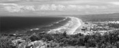
After a few hours of hiking, you’ll be rewarded by stunning 360-views of the whole island and Moreton Bay.
Brisbane is just about 25 kilometers off the island, so you will also have spectacular views of Sunshine Coast in the north and Gold Coast in the south. For the most adventurous souls, we recommend taking a tent with you and setting up a camping site near the peak.
During the bright days, your reward will include stunning sunrises and sunsets overlooking the whole island and crystal clear waters of the Moreton Bay.